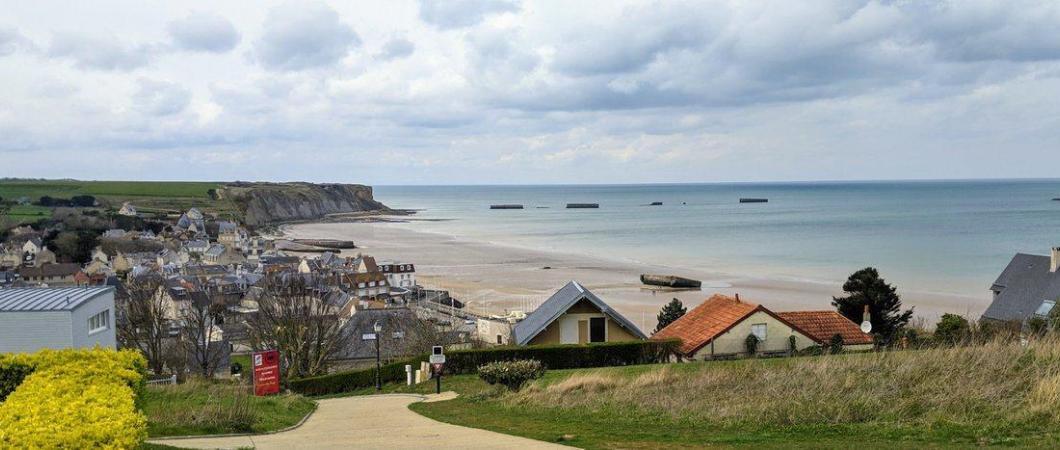
Arromanches-les-Bains is the site of the famous Mulberry B Artificial Harbour and home to the D-Day Landing Museum, known locally as the ‘Musée du Débarquement, Arromanches’, which focuses on the astounding piece of engineering that still dominates the seascape today.
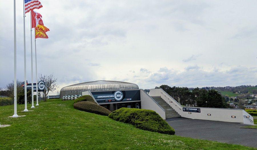
My last visit to the museum was in 2019. Since then the old single storey building has been demolished to make way for a shiny new building. Work began on the site in January 2021, and the new museum was opened at the start of April 2023.
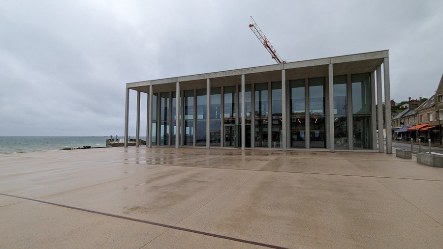
It’s much more spacious, thankfully – it only took a couple of school or tour bus groups turning up at the same time and you could barely move in the old building!
It’s also lighter. Tall, floor to ceiling windows look out over the remains of ‘Port Winston’.
And it’s also more ‘concretey’! It has a modern feel but the concrete reflects not only the massive Phoenix caissons that sit offshore, but also the remains of the Atlantik Wall that cover so much of this coastline. When you think about it, the entire coast of Normandy is pretty ‘concretey’!
D-Day Normandy Posts
History – the Mulberries
There were two Mulberry Harbours*. Mulberry A at Omaha Beach, didn’t last long. A violent storm on 19th – 21st June destroyed much of it and it had to be abandoned, leaving Mulberry B (aka “Port Winston”) to handle the lion’s share of supplies for the allied forces in Normandy.
The Cunning Plan
Planning for D-Day started in March 1943, although it had been known since Jan 1942 that there would be an invasion, and the Allies, especially the USA, were already building up their men and materials in preparation. The problem was ships.
Flat-bottomed landing ships couldn’t deliver the assault forces and then go on to deliver the continuous stream of weapons, vehicles, men, fuel, armaments and equipment needed to sustain them in battle. That would have to be done by ordinary cargo ships. Thankfully, the USA was beginning to outstrip merchant ship losses to U-boats in the Atlantic with their Liberty Ship programme. The problem was that ordinary deep-keeled merchantmen needed a port to unload, and there weren’t any of those on the coast of Europe. Nor were any likely to become available quickly even if captured. The Germans would do all they could to sabotage them. So, the Allies had to build their own port. As Vice-Admiral John Hughes-Hallett said: “If we can’t capture a port we must take one with us.”
The coast of Normandy can be unforgiving to the unprepared.Hmmm, not easy! I spent most of my teens & twenties sailing the Atlantic coast of France and those waters are tricky with a capital T! The tidal range is enormous. A normal Spring tide at Arromanches would be 6 metres (almost 20ft)**, and with all that water rushing out of the English Channel and then rushing back 6 hours later, you can imagine what the currents are like – even inshore in the Baie de la Seine it can be as high as 3-5 knots. Then add weather; high winds, rough seas, wind against tide. The coast of Normandy can be unforgiving to the unprepared.
So, the plan started with breakwaters, to afford ships large and small some protection and sheltered water. The allies decided to build breakwaters with floating ‘Bombardons’, scuttled ships and concrete ‘Phoenix’ caissons.
Bombardons were 200 ft concrete & steel tubes with a x-section in the shape of a cross. Three blades of the 2,000 ton Bombardon were below the water so the fourth made it look like a floating wall. They were strung together with fifty foot gaps between them and anchored to the bottom. Twenty-four bombardons would make up a mile of breakwater – and that was their function, to flatten out the wave movement. Bombardons and scuttled blockships were allocated to all the D-Day beaches*. The breakwaters of the two Mulberry harbours at Arromanches (Gold) and Saint Laurent-sur-Mer (Omaha) were made up of blockships and Phoenix caissons scuttled 2 kilometres offshore.
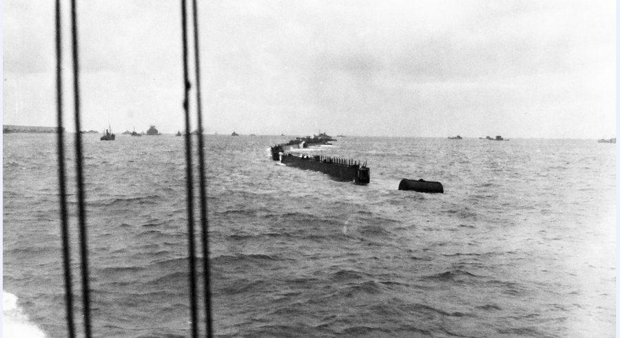
At the end of May 1944, 55 old warships and cargo ships were gathered in Loch Linnie, Scotland where they were prepared for scuttling, with explosives and concrete ballast. Then they set off with an escort to join the gathering fleet for D-Day. Meanwhile on 4th June, 146 giant concrete ‘Phoenix’ caissons of varying sizes, which had been constructed in secrecy over the previous 9 months and then sunk to hide them, were refloated and began their slow (4 knots) journey to Normandy, towed by 85 tugboats.
You’ve got to admit, that is spectacular planning and organisation on a grand scale, and we haven’t even talked about the piers!
Again, all this has to work across a huge tidal range. So a great deal of testing was involved in designing the wharves and piers heads needed to unload a large share of the estimated 38-40,000 tons of supplies needed daily.
Essentially the system works around huge wharf units fixed in position on four legs like an oil rig, and allowed to float up and down with the tide. This type of wharf is called a “Spud” wharf, but the wharf units in the Mulberry harbours were called Loebnitz wharves***. These are connected to the shore by a flexible roadway up comprising 80 ft bridging spans on floating concrete pontoons (“Beetles”). The causeways could be up to a kilometre long in order to place the wharves in water deep enough to allow a fully laden cargo ship alongside at low tide.
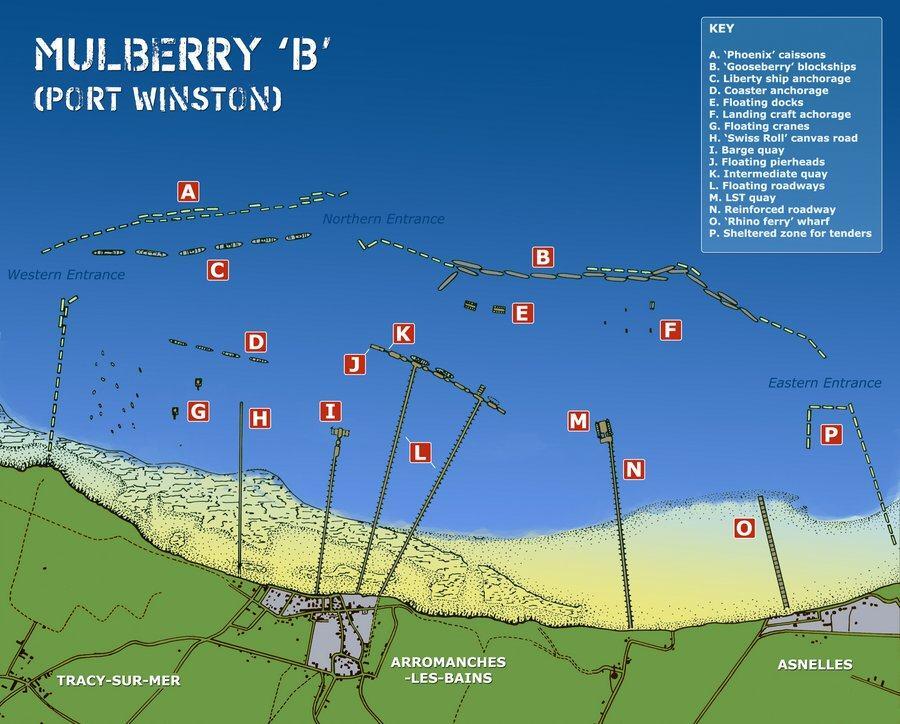
There were several causeway & wharf platforms (piers) at Mulberry B to allow for unloading offshore. The east pier was the pier for unloading tanks, bulldozers, artillery and other military vehicles from LSTs (Landing Ship Tank). It had one causeway because all the traffic was self-driving.
The main wharf was made up of seven platforms, allowing up to seven ships at a time to be unloaded. This was the general supplies wharf (food, medicines, clothes, materials, equipment, etc). This had two 1.2 kilometre floating causeways so a continuous stream of empty trucks could drive out on one, load up, and return to shore on the other.
To the west of the main wharf there is the pier for ammunition barges, and west of that, an interesting pier called a ‘Swiss Roll‘. It was a floating road surface, which in trials had proved capable of handling light vehicles up to 7 tons.
What’s left at Arromanches now?
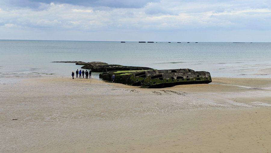
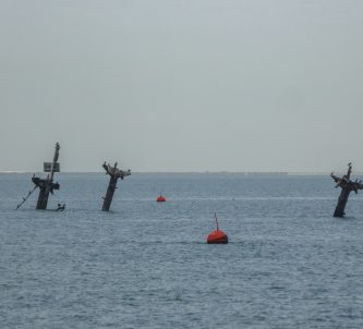
Well, the striking thing about the little town of Arromanches is the seascape. You can still clearly see twenty or so of the Phoenix caissons forming the semi-circular breakwater out to sea, and piled up on the beach, a set of concrete Beetle pontoons that supported one of the causeways 79 years ago.
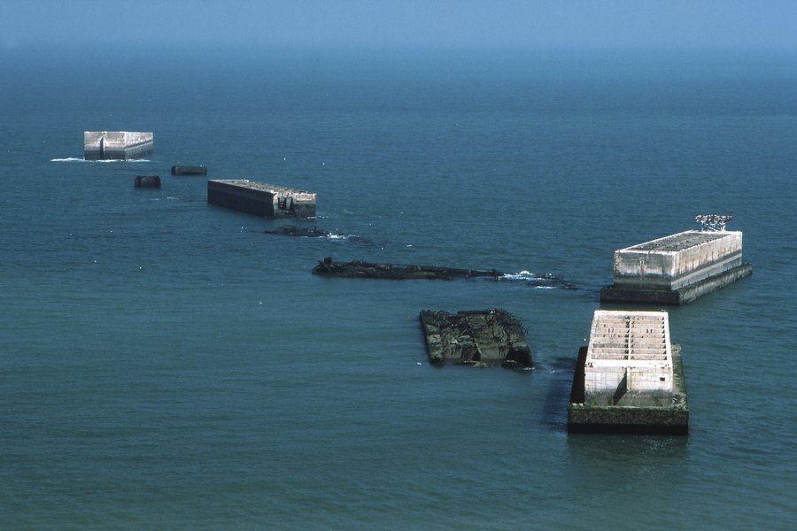
The Phoenix caissons came in different sizes, up to 70m long, to fit different parts of the breakwater. There’s only one example of the largest Phoenix caissons (No. 36), standing slightly by itself in the middle of the semicircle. It is around 20 m high and is thought to weigh as much as the Eiffel Tower – 7,000 tonnes.
The New D-Day Landing Museum
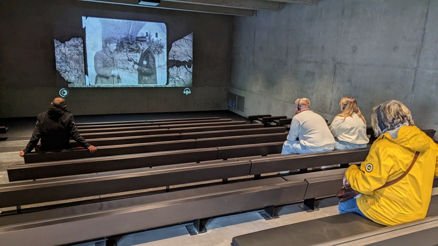
The new building is on two floors. The ground floor is taken up with the ticketing foyer, shop, locker areas and restrooms and the new 126-seat cinema which gives visitors an eight minute video summary of the invasion and the amazing Mulberry project.
The main part of the new museum is on the first floor, and it’s laid out in a trail.
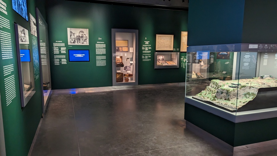
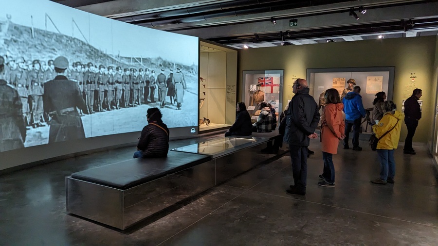
The first spaces focus on Arromanches under German occupation before the invasion, and on the role of the Resistance in gathering and supplying information to the Allies. It also highlights, with photographs and documents, the beginning of the invasion planning when Churchill, Roosevelt and Stalin started the ball rolling. There are display cabinets with German & Allied uniforms and equipment that lead through a corridor where the events of the night 6/7 June – parachute drops and bombing – are projected on the wall.
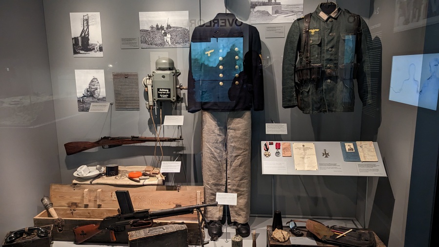
The next large space covers the landings. A 7-minute archive film explains how the landings (Operation Neptune) on the 5 beaches were achieved. The display cases around the walls have uniforms and equipment.
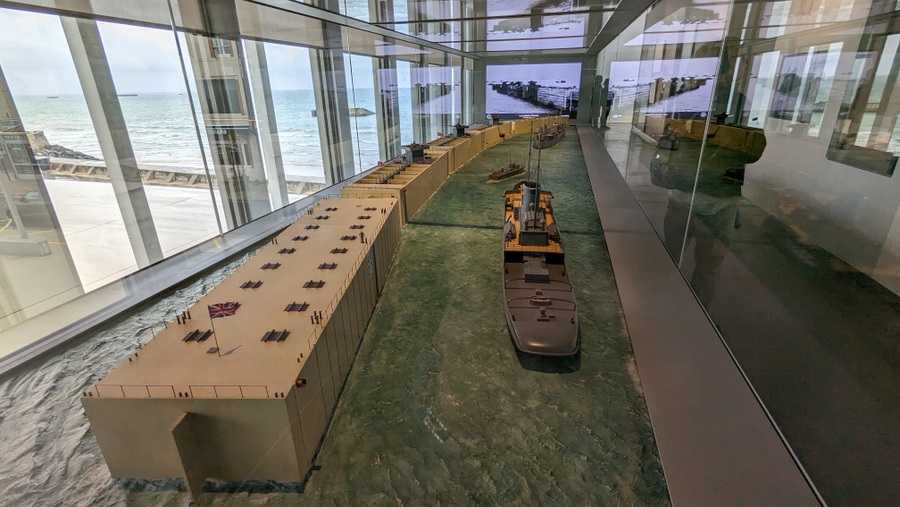
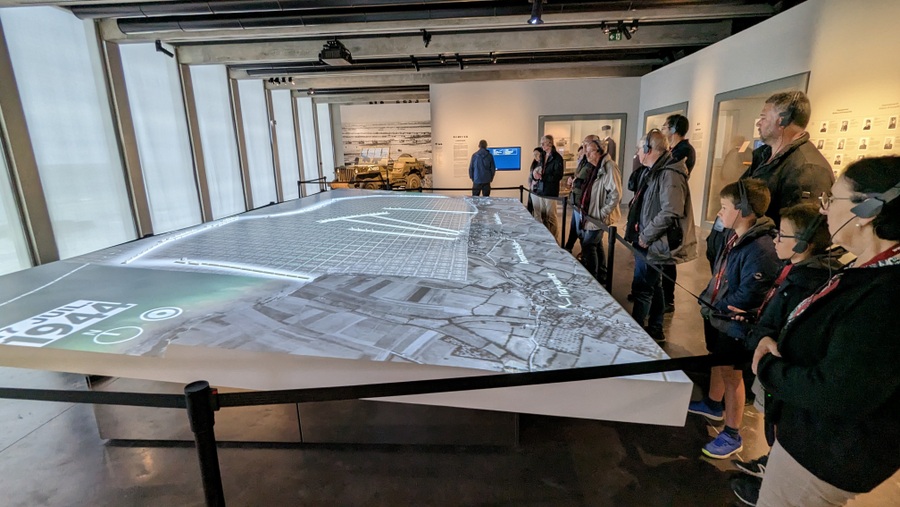
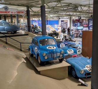
Then we get to the model gallery, where the brilliant models of the port, its breakwaters, its piers and roadways are on display. These models have been the centrepiece of the museum in its various iterations since 1956.
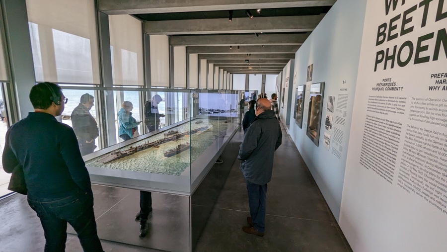
Here is the video I shot of them in the old museum.
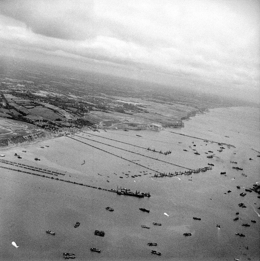
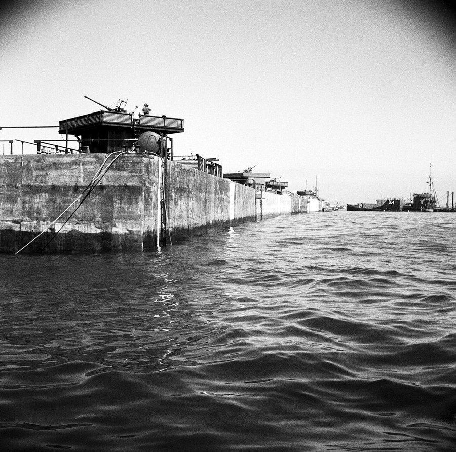
I’m really pleased to see this famous photograph on the wall (I can’t remember if it was on display in the old museum).
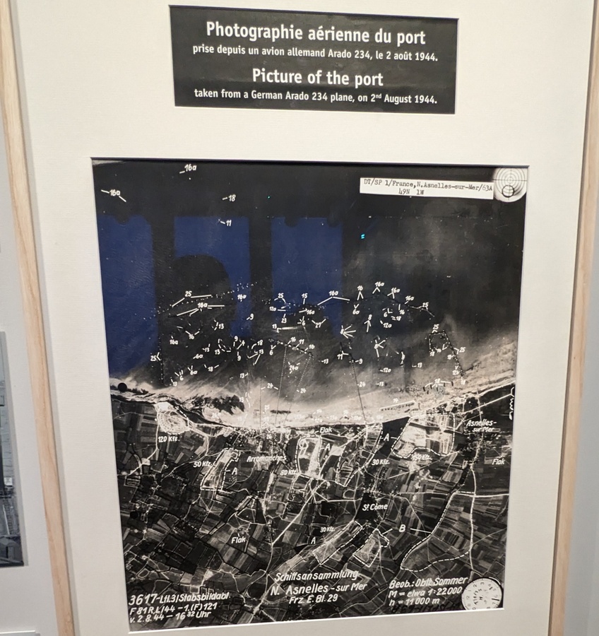
At 4.30pm on the 2nd August 1944 (D+57) as the Allies at Mulberry B were busy unloading the vast quantities of war materials needed to break out of Normandy, they were being photographed.
Luftwaffe pilot Erich Sommer was flying the world’s first combat mission by a jet reconnaissance aircraft, the Arado 234.
Erich had designed a rearward-facing periscope that he could use to check he wasn’t leaving a vapour trail, which might draw attention to his presence. He wasn’t. Not that it mattered much. Few enemy aircraft and no AA guns could reach him at 11,000 metres (36,090 ft), and travelling at 800 kph (497 mph)!
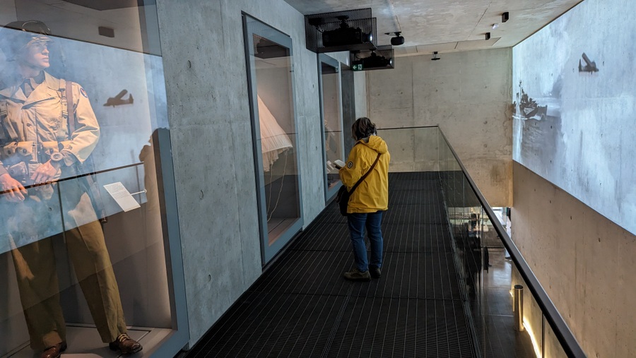
The next space has a huge 25 m² animated map of the port. There used to be a similar overview map in the old museum, but smaller. This is a projected map that has a rolling 15 minute display that explains how the port came together and how it worked. This large space has display cases around the walls with uniforms and information panels showing some of the personnel who worked on and in the port.
The last gallery looks at the progress of the Battle of Normandy and links in artefacts from other WW2 history museums around the region. I’m pleased to see one of their own artefacts, the wrecked Sabre III engine from a crashed Typhoon, is still here.
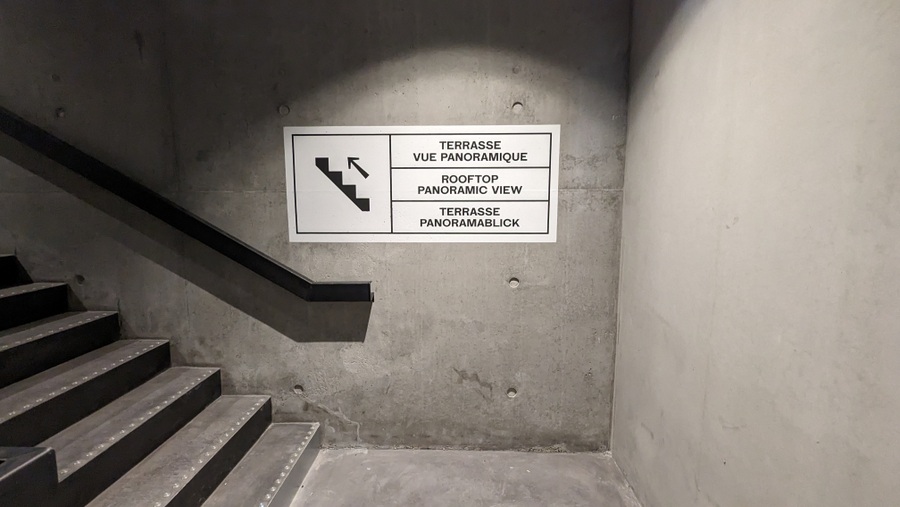
The new museum is not quite complete. Next year they will open a rooftop terrace that will allow a panoramic view of the remains of Mulberry B. The stairs are ready!
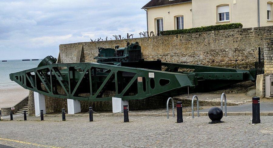
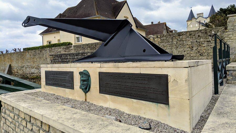
Outside the museum on the slipway down to the beach the standard 80 ft section of the causeway bridge span designed by Major Alan Beckett, and a memorial to his design genius, are still there.
Early on in the planning stage Churchill had, in a few words, identified one of their biggest problems – keeping the causeways in place in the tidal waters.
“Piers for use on beaches: – They must float up and down with the tide. The anchor problem must be mastered – let me have the best solution worked out. Don’t argue the matter. The difficulties will argue for themselves,” he wrote. Alan Beckett rose to the occasion, designing the roadway spans, Beetle pontoons and a new kind of “kite” anchor to hold them in place.
Visiting Arromanches
There is more than one element (the museum) to visiting Arromanches, so you might want to spend a few hours there.
You should take time to walk down onto the beach if the tide is out, and inspect the Beetle pontoons close up.
If you haven’t already parked up there, you should walk or drive up to the east cliffs where there are panoramic views of the Mulberry B breakwater caissons, and Arromanches 360, a cinema showing a 360° documentary about D-Day and the first 100 days of the Normandy campaign.
* Omaha & Gold had the Mulberries, but all the beaches were given breakwaters made up of Bombardons and blockships. The sheltered waters these provided so that landing craft, DUKWs and other small craft could more easily unload from bigger ships, were called ‘Gooseberies’.
** The highest range at Arromanches can be as much as 8 metres.
*** These wharves were based on a dredger designed & manufactured by Lobnitz and Co in Renfrewshire, who then made the Mulberry version.
Declaration: I was on a self-driving research trip accredited by Normandie Tourism. Museum entry was complementary.
Factbox 2023
Website:
Musée du Débarquement
Getting there: D-Day Museum
Place du 6 Juin
14117 Arromanches
France
When you drive down into Arromanches (it’s in a gully) keep going. The museum is right on the waterfront in the centre of town. However, parking is extremely limited in the town. You are encouraged to park up on the east cliff and walk down.
Entry Price:
| Individual | Group (20+) | |
|---|---|---|
| Adult | € 12.70 | € 9.20 |
| Child (6 – 18), student | € 8.20 | € 5.60 |
| Family ticket €36 (2 adults and 2 children of 6 – 18 yrs Extra child = 4€) |
||
Opening Hours:
The museum opened 1st April 2023
| Apr, Sep | 09:00 – 18:00 Daily* |
| May | 09:00 – 19:00 Daily* |
| Jun, Jul, Aug | 09:00 – 19:00 Daily |
| Sep | 09:00 – 18:00 Daily* |
| Oct | 09:30 – 12:30 & 13:30 – 17:30 Daily* |
| Nov, Dec | 10:00 – 12:30 & 13:30 – 17:00 Daily* (Except 24, 25 & 31 Dec) |
* Except Sundays when it opens at 10:00 (Jun, Jul, Aug open at 9:00)
Further reading…
- The D-Day Center (who loaned me their map) has some great content on visiting Normandy.
- Mulberry Harbour Info focuses on the trials & development of Mulberry components in Scotland
- Combined Operations has a quite detailed post on the Mulberry harbours.
- HKSW has some really good drawing of Mulberry components, inc a good one of Bombardons
I think the new museum is a great addition to the Arromanches area. It’s a more modern and interactive way to learn about D-Day, and I think it will appeal to a wider range of visitors. I’m definitely planning to visit the museum when I’m next in Normandy.”
I agree, John. I think it’s a great improvement and the roof gallery will top it off, so to speak, next year! 🙂