This is some interesting engineering. Have you wondered, as you watch your Amazon parcel “just 5 stops away”, what our world would look like if we suddenly lost GPS?
It’s not just you, and a squillion delivery drivers. It would effect all transport systems (apart maybe for rail!), and it’s estimated that just a short 24-hour GNSS outage could cost the entire UK economy £1.4 billion through cascading effects on logistics, transportation, and critical infrastructure, which goes to underscore the need for GNSS-independent solutions.
So this is reassuring news at a time when international tensions are high*.
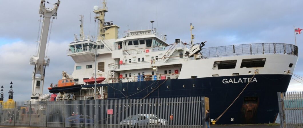
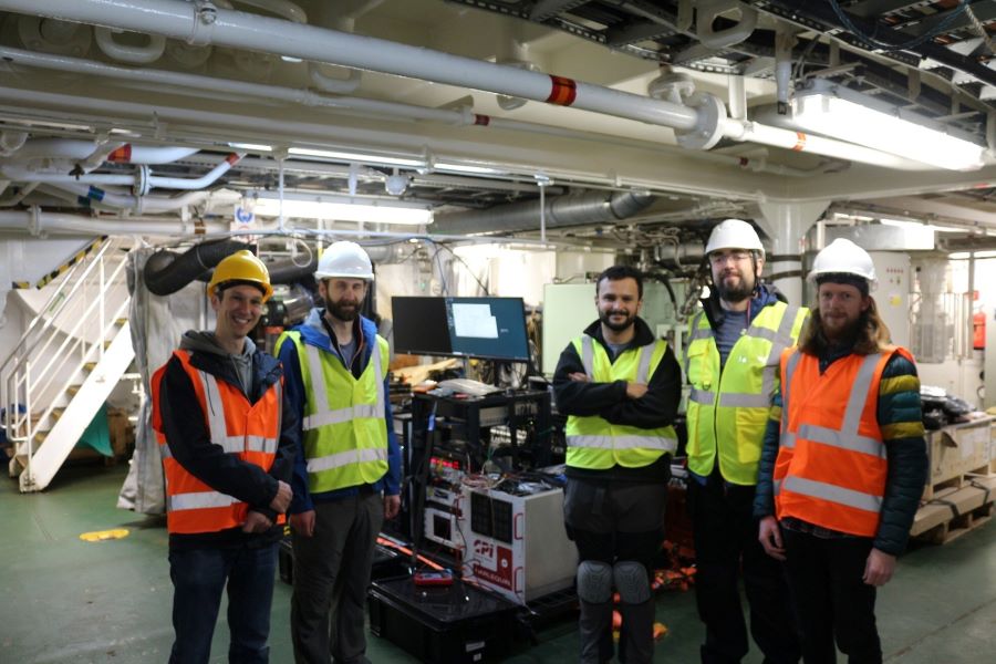
A company called CPI Electron Device Business – TMD Technologies Division (“CPI TMD”) has successfully completed sea trials of its HARLEQUIN quantum-hybrid Inertial Navigation System (INS) aboard the Trinity House Vessel Galatea.
Trinity House, of course, is the General Lighthouse Authority for England, Wales, the Channel Islands and Gibraltar, responsible for buoyage, lights, marks and navigation signals in those waters. So, it’s important for them to know where they are!
What is a quantum-hybrid inertial navigation system? Well, think of it as an ordinary Inertial Navigation System on steroids!
Here comes the detailed explanation. Take a sip of your coffee and buckle up…
HARLEQUIN** integrates classical INS components (a precise clock, a ring laser gyroscope, and a MEMS accelerometer) with CPI TMD’s gMOT-based quantum accelerometer.
The gMOT cold atom source, developed by CPI TMD, the University of Strathclyde and Kelvin Nanotechnology, is a grating-based magneto-optical trap that provides a source of ultra-cold atoms that forms the basis of a portable, rugged quantum sensor.
Conventional INS technology accumulates errors over time, causing position estimates to drift. By integrating its cold-atom accelerometer technology with classical INS technology, HARLEQUIN improves quantum-enhanced sensing to perform periodic drift corrections, extending the period over which a vessel can maintain accurate position in the absence of satellite-derived timing and positioning.
(There’s an even deeper dive into cold-atom accelerometers in this Sep 2024 video from Dr Ben Miles.)
The HARLEQUIN sea trial demonstrated that quantum sensors can operate reliably outside the lab, functioning in the harsh conditions of real-world maritime operations—a crucial validation step toward field-deployable systems.
THV Galatea is not a scientific test vessel but an operational ship with a demanding day job: keeping shipping routes safe by ensuring buoys and lights are correctly placed and maintained, surveying the seabed for hazards, marking wrecks, and supporting marine-infrastructure projects such as cables and pipelines.
Data gathered during the trial will now be used to make system upgrades aimed at improving performance and enhancing suitability for long-term shipboard operation. A second field trial is planned for the end of 2026 to validate improvements, though it’s not clear if THV Galatea will be involved.
Unlike most Mechtraveller posts, this is interesting transport tech that may affect your travelling life, but I can’t tell you where you can see it… still, you can wave to THV Galatea next time you see her around the UK, Channel Islands or Gibraltarian coast!
* GNSS signals are increasingly vulnerable to intentional jamming and spoofing and cannot penetrate underwater, underground, or heavily built-up environments. Governments and industries are actively seeking alternatives to satellite-dependent systems.
** The HARLEQUIN system has been developed under an Innovate UK funded project, with partners from industry and academia, including the University of Strathclyde, and Dr. Joseph Cotter’s group at Imperial College London.